

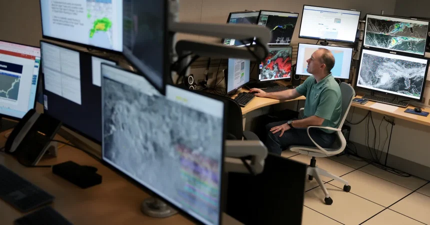
For much of 2026, the Atlantic hurricane season has been the kind of quiet that makes people along the Gulf Coast breathe a little easier. After months of watching satellite loops and refreshing forecast models, residents and meteorologists alike have enjoyed what can only be described as a mercifully dull stretch. There have been named storms, yes, but no hurricanes, no major evacuations, no boarded-up windows, no frantic runs on bottled water and plywood. It felt, for a while, like the ocean had decided to give everyone a pass. But that is about to change. Tropical Storm Isaias is churning in the Gulf of Mexico with winds of 65 miles per hour, according to the latest update from the US National Hurricane Center. That is just a shade below hurricane strength, the kind of number that makes forecasters raise an eyebrow and coastal residents start paying closer attention. The storm is expected to become the season’s first hurricane before making landfall somewhere between Mississippi and Florida by the weekend. It is the kind of forecast that turns a quiet season into a suddenly serious one, and it is a reminder that the Atlantic can go from sleepy to dangerous in a matter of days.
Why has this season been so quiet? The short answer is El Niño, but the full story is a little more complicated and a lot more fascinating. El Niño has essentially turned the Atlantic basin into a graveyard for tropical cyclones by changing the winds high in the atmosphere. Those winds, known as wind shear, tear storms apart before they can organize into powerful systems. Imagine trying to build a sandcastle while someone keeps kicking sand at it; that is what wind shear does to a developing hurricane. This year’s El Niño has been especially strong, with meteorologists throwing around unofficial superlatives like “super,” “Godzilla,” and “supersized.” Those words are not official designations, but they capture the sheer magnitude of the event. El Niño is measured by ocean temperatures in a part of the tropical Pacific, and this year’s iteration has seen record highs throughout the summer and into the first part of fall. That warmth has rearranged weather patterns around the world, including over the Atlantic, where it has helped suppress tropical cyclone activity to near-record-low levels. The result has been zero hurricanes, a statistic that seemed almost unthinkable at the start of the season. Saharan dust has also played a role, making the air in one of the major hurricane development zones too dry for storms to thrive. It has been a perfect storm of conditions working against storm formation, and for that, many people are grateful.
Now Isaias is trying to buck the trend. The storm is currently moving through the Gulf of Mexico, and it is forecast to pass over a patch of abnormally warm water. That warm water is like rocket fuel for tropical systems, providing the energy needed for a storm to intensify. Forecasters expect Isaias to blossom into a hurricane, and it could peak as a Category 2 storm with winds of 110 miles per hour as it lumbers to the northeast. There is something almost cinematic about a storm gathering strength over warm seas, feeding on heat and moisture, growing from a disorganized cluster of thunderstorms into a swirling, powerful system. But the same wind shear that has kept the season so quiet is expected to return, and Isaias is likely to weaken shortly before it makes landfall somewhere along the Gulf Coast. It is like a runner who sprints toward the finish line only to hit a wall of resistance in the final strides. That does not mean the storm will be harmless, though. Even a weakened hurricane or strong tropical storm can bring dangerous winds, heavy rain, and life-threatening storm surge. The exact track and intensity remain uncertain, which is always the most stressful part of hurricane forecasting. People in the Gulf Coast region know that a storm can wobble, stall, or suddenly strengthen, and they are watching Isaias with a mixture of caution and concern.
Officials are not taking any chances. The National Hurricane Center has issued hurricane watches for all of the coastline in Mississippi and Alabama, as well as parts of the Florida Panhandle. Tropical storm watches extend into Louisiana as well, meaning that the entire northern Gulf Coast is on alert. The potential impacts are serious. Rainfall totals could reach up to 7 inches across the region, with some spots in the Panhandle seeing as much as 10 inches. That is enough rain to flood streets, overwhelm drainage systems, and turn low-lying neighborhoods into temporary lakes. Storm surge could reach as high as 7 feet, which means water from the Gulf could be pushed inland, threatening homes, businesses, and roads. Tornadoes are also not out of the question, as is often the case with landfalling tropical systems. These storms can spin up quick, short-lived tornadoes that add an extra layer of danger to an already hazardous situation. In other words, this is a storm to take seriously, even if it is not the catastrophic monster that some seasons produce. Emergency managers are urging residents to review their plans, gather supplies, and stay informed. There is a certain rhythm to hurricane season, a familiar dance of watches and warnings, and this week the music has started again. For those who have lived through past storms, the anxiety is real, but so is the resolve. Communities along the Gulf Coast know how to prepare, and they are doing just that.
Isaias could also make history, or at least tie it. If it becomes a hurricane, it would be the latest-forming first Atlantic hurricane on record. The current record was set in 1905, when the season’s first hurricane formed on October 8. That is a remarkable piece of trivia, and it speaks to just how unusual this year has been. The Atlantic hurricane season officially runs from June 1 to November 30, and it is rare for the first hurricane to wait this long. Records are funny things; they are often broken by a few hours or a few miles, and this one is no exception. There is still one more update scheduled for Isaias on Wednesday, so it is possible the storm could just miss out on tying that mark. But record or not, Isaias is indicative of the hurricane season that wasn’t. This year’s Atlantic hurricane season was forecast to be below average, but it has been even quieter than expected. The combination of a powerful El Niño, persistent wind shear, and dry, dusty air from the Sahara has created conditions that are almost hostile to hurricane development. For meteorologists, it has been a fascinating case study in how large-scale climate patterns can shape a season. For coastal residents, it has been a welcome reprieve, a chance to enjoy the late summer and early fall without the constant dread of a major storm bearing down.
Record or not, Isaias is a reminder that the ocean always has the final say. The same El Niño that has suppressed hurricanes this year is a testament to the interconnectedness of the planet’s climate system. Warm water in the tropical Pacific can influence winds, rainfall, and storm activity thousands of miles away, and this year’s “Godzilla” El Niño has been a dominant force. The record-high ocean temperatures in the Pacific have been matched by unusually warm waters in the Gulf of Mexico, which is part of what is fueling Isaias. It is a strange paradox: a season that has been quiet because of El Niño is now facing a storm that is intensifying because of warm water. Saharan dust, too, has played a role in quieting things by making the air in one of the major areas where hurricanes develop too dry for sustained thunderstorm activity. But dust comes and goes, and El Niño will eventually fade, and the Atlantic will eventually wake up. For now, the focus is on Isaias and the people in its path. The storm is a reminder that hurricane season is not over, that preparation is not optional, and that even in a quiet year, nature can still throw a curveball. As the Gulf Coast braces for the weekend, there is hope that Isaias will weaken, that the rain will be manageable, and that the season’s first hurricane will also be its last. But hope is not a plan, and the next few days will require patience, vigilance, and a healthy respect for the power of the sea.