Following the devastating dual earthquakes that struck Venezuela on June 24, 2026, the global scientific community has mobilized an unprecedented technological response to aid in disaster relief. As traditional ground communication networks often collapse in the immediate wake of such natural disasters, the reliance on high-orbit satellite technology has become the lifeline for emergency responders on the ground. By capturing real-time imagery and topographical data from space, international space agencies are providing the Venezuelan government and humanitarian organizations with a “god’s eye view” of the crisis, allowing them to transform a chaotic disaster zone into a strategically managed operation.
The European Union’s Copernicus satellite system was among the first to leap into action, activating its emergency mapping mode at the direct request of the European Commission. This system has acted as a digital cartographer for chaos, processing vast streams of data from Sentinel satellites to generate comprehensive map products. By analyzing thirteen critical areas of interest, these digital assets have allowed officials to conduct a precise, real-time assessment of how the terrain has shifted and where the infrastructure is most compromised. This level of granular visibility is essentially a roadmap for survival, highlighting not just where the destruction lies, but where rescue teams can safely land aircraft to drop essential supplies and extract the injured.
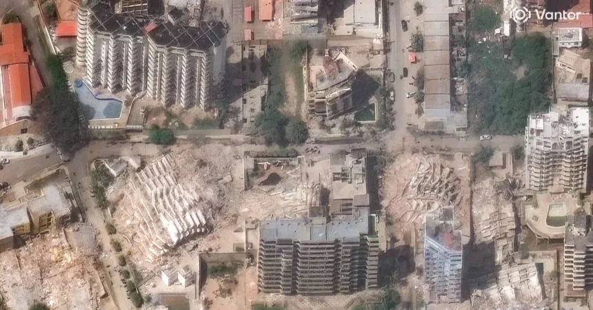
The human toll of the seismic event is starkly illustrated by the data harvested from the sky. Copernicus reports that by June 27, nearly 1,300 buildings had sustained significant damage, with the cities of La Guaira and Greater Caracas bearing the brunt of the instability. The reports also detail widespread destruction across the regions of Aragua, Carabobo, Falcón, and Miranda, painting a haunting picture of fractured lives across multiple states. Having these maps allows rescue coordinators to prioritize the most severely impacted neighborhoods, ensuring that the limited time and resources they have are deployed where they will save the maximum number of lives.
In a powerful display of international scientific cooperation, NASA has stepped in to complement the European efforts by activating its Disaster Response Coordination System. While Copernicus focuses on structural damage and logistics, NASA is utilizing data from the groundbreaking NISAR mission to analyze the actual movement of the Earth’s crust. By measuring the displacement of the surface, scientists are providing emergency managers with deeper insights into the seismic stability of certain regions. These radar-informed assessments are critical for predicting potential aftershocks and identifying areas where the ground remains too unstable to support heavy rescue equipment or temporary shelters.
This collaborative pilot project between NASA and Copernicus represents a new frontier in humanitarian aid, where radar imagery is used to verify damage probability with sobering accuracy. By overlaying “before and after” snapshots captured by the Sentinel-1 satellite, agencies can now identify areas with upwards of a 75 percent probability of structural failure. These areas are marked with red dots on sophisticated maps, serving as a warning to ground teams about the precarious nature of the buildings they are entering. This partnership ensures that no data goes to waste, creating a singular, unified stream of intelligence that empowers local authorities to act with confidence rather than guesswork.
Ultimately, the tragedy in Venezuela serves as a profound reminder of how far technology has progressed in the service of humanity. While the earthquakes left scars across the landscape, the information beamed down from space is actively closing the gap between the victims who need help and the rescuers who are rushing to reach them. By turning abstract satellite telemetry into actionable, life-saving maps, the global community is providing more than just data; they are providing hope. As recovery efforts continue in the coming weeks and months, these tools will remain indispensable, guiding everything from urgent search-and-rescue maneuvers to the eventual, long-term reconstruction of the affected communities.