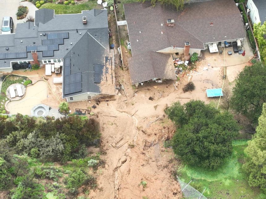
The United States Geological Survey (USGS) has initiated a $1 million grant program aimed at mitigating the escalating threat of landslides across the nation. This investment comes in response to the growing economic and human costs associated with these natural disasters, exacerbated by the intensifying impacts of climate change. Landslides, triggered by a variety of factors including earthquakes, volcanic eruptions, storms, snowmelt, and wildfires, inflict an estimated $1 billion in economic damages annually and tragically claim between 25 and 50 lives each year. These events, characterized by the rapid downslope movement of rock, soil, debris, mud, and floodwaters, pose a significant risk to communities nationwide. The USGS highlights the link between climate change and increased landslide activity, noting that more intense rainfall patterns, a consequence of warming temperatures, can trigger these destructive events. Furthermore, the agency emphasizes the connection between climate change, more frequent and intense wildfires, and subsequent landslides in burned areas where altered soil and vegetation create conditions ripe for slope instability.
The USGS grant program, funded through the Cooperative Landslide Hazard Mapping and Assessment Program, targets local, state, tribal, and territorial governments to support projects that reduce landslide risks. This initiative acknowledges the widespread nature of the threat, affecting all 50 states and U.S. territories. The grants will fund a range of activities, including landslide-related communications, planning, coordination, mapping, risk assessments, and data collection. The program represents a critical step towards enhancing national landslide preparedness in the face of evolving climate risks. The USGS is actively seeking proposals for the second round of Fiscal Year 2025 grants, with a deadline of January 15, 2025. The initial round of FY2024 grants supported nine projects across ten states, showcasing a geographically diverse approach to addressing landslide hazards. These projects exemplify the commitment of various regions to proactively manage and mitigate landslide risks within their specific contexts.
One illustrative example of a funded project is the Utah Geological Survey’s initiative to develop a comprehensive landslide inventory for mountain valleys along the Wasatch Front. This $302,494 project, partially funded by a $151,247 federal grant, addresses the growing landslide risk in this densely populated area. As urban development expands into steeper, more vulnerable slopes in the foothills and lower mountain canyons, the potential for landslides impacting communities and infrastructure increases. The project aims to create a detailed record of past landslides, informing future development planning and mitigation strategies. The Utah Geological Survey underscores the historical impact of landslides in the state, citing 342 deaths since 1850. While the majority of these fatalities are attributed to snow avalanches, a significant portion involve landslides, rockfalls, and debris flows. The survey also notes that the majority of landslide-related deaths since 1950 have been linked to human-triggered avalanches, often occurring in developed areas where appropriate mitigation measures should be implemented. The economic toll of landslides in Utah ranges from millions to hundreds of millions of dollars, highlighting the significant financial burden these events impose.
The enhanced focus on landslide preparedness at the federal level is driven by the 2021 National Landslide Preparedness Act. This legislation mandates the USGS to develop and implement a national landslide hazards strategy, encompassing risk reduction measures, a public database of landslide hazards and risks, and the expansion of early warning systems for flash floods and debris flows. The Act also compels the USGS to establish procedures for rapid deployment of scientists, equipment, and services to landslide-affected areas during emergencies. Furthermore, the legislation emphasizes collaboration with other federal agencies, such as the Federal Emergency Management Agency (FEMA), to streamline response and recovery efforts. This integrated approach recognizes the importance of coordinated action across government agencies to effectively address landslide hazards.
FEMA plays a critical role in public education and outreach regarding landslide risks. The agency provides sobering statistics, such as the over 100 landslide-related deaths in California in the last 25 years, predominantly due to debris flows burying individuals in their homes. FEMA emphasizes the speed and destructive power of landslides, which can reach speeds of up to 100 mph, often transforming into mudflows with high water content. The agency provides essential safety information, including evacuation guidelines, advice on recognizing warning signs of landslides and flooding, and the importance of staying informed through emergency alerts. This public education component is vital for empowering communities to take proactive steps to protect themselves during landslide events.
The USGS grant program empowers state and local governments to take concrete action to mitigate landslide risks, thereby reducing both human casualties and economic losses. This proactive approach is particularly important in the context of climate change, which is driving an increase in extreme weather events, wildfires, and subsequently, landslides. The grants provide crucial resources for communities to enhance their preparedness and resilience in the face of these escalating threats. By supporting research, mapping, risk assessment, and communication efforts, the program fosters a more comprehensive and proactive approach to landslide hazard management, ultimately contributing to safer and more resilient communities nationwide.


