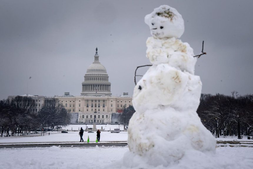
A potent winter storm swept across the central and eastern United States in early January 2025, bringing heavy snow, ice, blizzard conditions, and dangerously low temperatures. Initially impacting the Central Plains over the weekend, the storm tracked eastward, leaving a trail of disruptions in its wake. Millions of residents across the Mid-Atlantic region found themselves under winter weather warnings, bracing for the storm’s full impact on Monday. The National Weather Service (NWS) predicted significant travel delays and major impacts across several states, including West Virginia, Maryland, Virginia, Washington D.C., and Delaware.
The storm’s reach was extensive, blanketing a wide area from central Kansas to Maryland with over half a foot of snow. Southern Ohio and the D.C. area anticipated snowfall totals between 6 and 12 inches, while certain regions of Kansas and Missouri, under blizzard warnings, prepared for upwards of 15 inches—a potential record-breaking accumulation for some localities. Beyond the snow, the storm also packed powerful winds. Blizzard warnings were issued for parts of Kansas, Nebraska, and Missouri, with gusts exceeding 40 miles per hour. The Mid-Atlantic braced for wind gusts up to 25 miles per hour, further complicating travel and increasing the risk of power outages.
Adding to the hazardous conditions, the storm brought a significant threat of icing and freezing rain, stretching from central Kansas through the central Appalachians. The NWS warned of widespread tree damage and power outages due to ice accumulation, with some areas potentially experiencing over half an inch of ice. This combination of snow, wind, and ice created treacherous travel conditions, forcing road closures and prompting officials to urge residents to stay home if possible. The storm’s intensity and widespread impact prompted school closures across multiple states and triggered travel disruptions across air and rail networks.
The storm’s impacts rippled through daily life, forcing school closures in major districts across the D.C. area, Kentucky, Ohio, Indiana, Maryland, and Virginia. Students and families prepared for an unexpected day off as schools shifted to remote learning options where possible or declared traditional snow days. The travel chaos was widespread, with over 1,000 U.S. flights cancelled and another 460 delayed on Monday morning, following even higher cancellation and delay numbers on Sunday. Airports in the D.C. area experienced the brunt of the disruptions, with hundreds of flights cancelled at Reagan National, Baltimore/Washington International, and Dulles International airports. The ripple effect reached Amtrak, which cancelled dozens of trains along the Northeast Corridor and in the Midwest.
The storm’s heavy snow and ice accumulation led to widespread power outages across multiple states. Tens of thousands of customers in Kentucky, Indiana, Illinois, Missouri, and West Virginia faced power disruptions, adding another layer of difficulty to the already challenging conditions. Utility crews worked diligently to restore power as quickly and safely as possible, but the widespread nature of the outages posed significant logistical challenges. The storm’s aftermath left communities grappling with snow removal, downed trees, and power restoration efforts.
Beyond the immediate impacts of heavy snow and ice, the storm also ushered in a period of frigid temperatures. Meteorologists anticipated that the arctic air accompanying the storm could result in the coldest January in the U.S. since 2011, marking a significant departure from the relatively mild fall season. This extended period of cold temperatures posed further risks to vulnerable populations and placed additional strain on energy grids. The storm served as a stark reminder of the variability of winter weather and the importance of preparedness. The NOAA’s earlier winter outlook had predicted above-average temperatures for much of the south and east, highlighting the unexpected nature of this severe winter weather event.


